Flooding in the Sunken Lands comes from two directions. Headwater flooding flowing from the headwaters in the mountains of Missouri, and backwater flooding pushing up from the mouth at the Mississippi river. Two federally funded projects have focused on reducing the impacts of these sources. Lake Wappapello is situated along the St Francis River channel at the edge of the MAV, and was authorized as a flood management project to hold water and slow the flooding downstream into the Sunken Lands and adjacent agricultural areas.

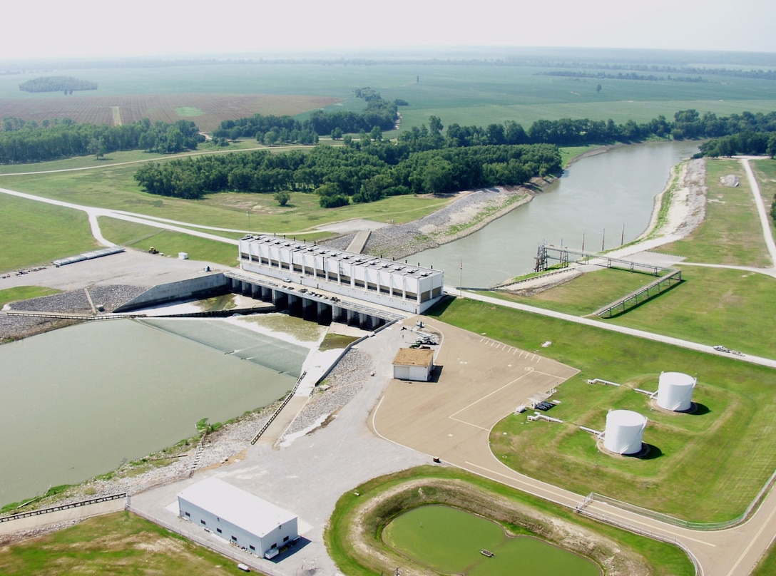
Near the mouth of the St. Francis River at Marianna Arkansas, the Huxtable Pumping Station and dam was created to restrict the backwater flooding off the main channel of the Mississippi River, but still allow for the flow of water from the St. Francis into the Mississippi. When the Mississippi reaches 177 feet above sea level, or exceeds the height of the St. Francis, the gates are closed, and the world's largest freshwater storm runoff pumps are turned on to pump the entire flow of the St. Francis River into the Mississippi.
https://www.mvm.usace.army.mil/Media/Images/igphoto/2000757605/
Flooding continues to be a significant part of the lifecycle of the watershed. Even with over 120 years of projects and engineering, mother nature has still shown her might with recent major flood events in 2011, 2017, and the longest period of flooding in history in the first half of 2019. Recent floods have come with significantly less loss of life and property than those of years past, due to the extensive flood control structures that are in place, but I find myself torn. When I consider the massive loss of habitat that has occurred in the last 200 years, weighed against the production of those lands and the benefits to humans, both locally and worldwide through food production, I often wonder if it was worth the cost.
No comments:
Post a Comment